Hurricane Genevieve is remaining far offshore, but its long-period swell is moving toward Southern California. Forecasts indicate that exposed Orange and San Diego County beaches could see 9- to 11-foot breakers Thursday and Friday, bringing heightened rip-current, dangerous-swimming and minor coastal-flooding concerns.
Key Takeaways
- Hurricane Genevieve briefly reached Category 5 strength early Monday, July 27, before weakening to a Category 4 hurricane with sustained winds near 155 mph.
- The hurricane’s center is forecast to remain far offshore, with no direct wind or rainfall impacts expected in California.
- South-southwest-facing beaches in Orange and San Diego counties could see breaking waves of 9 to 11 feet Thursday and Friday.
- Evening tides near 6 to 6.5 feet could combine with the swell to produce minor tidal overflow or localized coastal flooding.
Hurricane Genevieve’s most immediate effect on the United States is expected along the shoreline rather than from a landfall. The storm is sending wave energy northward across the eastern Pacific while its center remains hundreds of miles from California.
Genevieve became the first Category 5 hurricane in the eastern Pacific since Hurricane Kristy in 2024 when its sustained winds reached 160 mph early Monday. By 8 a.m. MST, the National Hurricane Center placed the storm about 520 miles south-southwest of the southern tip of Baja California, with sustained winds near 155 mph.
No coastal watches or warnings were issued for the hurricane’s core. However, forecasters continued to warn that swells generated by Genevieve could produce life-threatening surf and rip-current conditions far from its center.
Hurricane Genevieve Swell Builds Toward Thursday
A persistent southwesterly swell was already producing elevated surf across parts of Southern California early in the week.
The National Weather Service in San Diego forecast surf of approximately 3 to 5 feet, with sets reaching about 6 feet, through Wednesday. A larger swell associated with Hurricane Genevieve is expected to begin building Wednesday afternoon or evening.
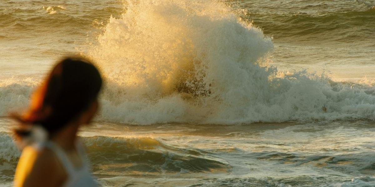
Current guidance places the incoming swell near 5 to 7 feet with a period of approximately 14 seconds. As the swell enters shallower coastal waters, breaking waves of 9 to 11 feet could develop at exposed south-southwest-facing beaches Thursday and Friday.
The longer wave period indicates that larger sets may arrive with substantial energy, even when conditions appear temporarily calmer between waves. This can allow individual breakers to reach farther onto beaches and exposed coastal structures.
The highest-risk period is currently centered on the second half of the workweek. Forecasters noted that the eventual wave size remains partly dependent on Genevieve’s strength, track and the direction of the swell as it moves north.
South-Facing Beaches Face the Highest Surf
The largest breaking waves are not expected along every section of the Southern California coastline.
Orange and San Diego County beaches that face south or southwest are positioned to receive the most direct energy from the incoming swell. Sheltered beaches and west-facing areas may see different conditions because offshore islands, coastal shape and underwater terrain can alter how waves reach the shoreline.
Those differences are visible across California surfing locations, where exposed points and open beaches can respond differently to the same offshore swell.
Specific wave heights may also vary within a single county. Beach visitors should rely on local lifeguard instructions, posted warning flags and updated forecasts rather than assuming conditions will be uniform across the coast.
Parts of Los Angeles and Ventura counties were also experiencing elevated surf from a combination of southern swells. National Weather Service forecasts indicated surf of roughly 3 to 6 feet at coastal beaches in those areas, with conditions subject to change as Genevieve’s swell approaches.
Rip Currents and High Tides Increase Coastal Risk
Large breaking waves are only one part of the expected hazard.
Strong rip currents can carry swimmers away from shore, while longshore currents can move people rapidly along the beach and toward piers, rocks or harbor structures. Conditions can remain dangerous even at beaches where the largest forecast wave heights do not occur.
A Beach Hazards Statement was in effect through 6 p.m. Wednesday for Orange and San Diego County coastal areas. The statement cited elevated surf, increased rip-current risk, dangerous swimming conditions and the possibility of minor coastal flooding.
Evening high tides were forecast to reach approximately 6 to 6.5 feet through much of the week. Forecasters said the combination of higher tides and the incoming Genevieve swell would likely cause at least minor tidal overflow, with more noticeable coastal flooding possible when the largest waves arrive.
The offshore nature of the threat distinguishes Genevieve from major California storm impacts involving direct rainfall, strong winds, evacuations and inland flooding.
California is not expected to receive the hurricane’s core weather. The ocean response may still produce hazardous conditions along beaches, harbor entrances, jetties and low-lying coastal walkways.
Wave run-up can move farther onto the beach than visitors expect. Rocks and breakwaters that appear dry between sets may be covered suddenly when a larger wave reaches the shoreline.
Beach Safety Remains the Central Concern
Beach visitors should review updated National Weather Service alerts before traveling to the coast. Conditions may change by location, tide cycle and time of day, including between neighboring beaches.
Swimmers should remain near staffed lifeguard towers and stay out of the water when local authorities advise against entering. People standing on rocks, jetties or breakwaters should maintain additional distance from breaking waves.
A person caught in a rip current should remain calm and avoid trying to swim directly against the flow. NOAA guidance recommends floating or treading water, signaling for help and swimming parallel to the shoreline when possible until clear of the current.
Genevieve is expected to weaken gradually as it continues over open water. That weakening will not immediately stop the swell already traveling north toward Southern California.
The main window for hazardous surf is expected from Wednesday afternoon through Friday. Hurricane Genevieve is not forecast to strike California, but its distant swell could still create dangerous conditions for swimmers, surfers, boaters and people near exposed shoreline structures.
Frequently Asked Questions
Will Hurricane Genevieve Hit California?
Hurricane Genevieve is not forecast to make landfall in California or bring its core winds and rainfall to the state. Its primary California impact is expected to come from long-period ocean swells reaching Southern California beaches.
When Will the Largest Waves Reach Southern California?
The Genevieve swell is expected to begin building Wednesday afternoon or evening. The largest breaking waves are currently forecast for Thursday and Friday.
Which Beaches Could See the Highest Surf?
South-southwest-facing beaches in Orange and San Diego counties have the greatest chance of receiving 9- to 11-foot breaking waves. Actual conditions will vary depending on beach orientation, underwater terrain and exposure to the swell.
Why Are Rip Currents Dangerous During High Surf?
Rip currents can move swimmers quickly away from the shoreline and may be difficult to recognize from the water. Swimmers should stay near lifeguards and avoid fighting directly against a current if they are pulled offshore.
Could Hurricane Genevieve Cause Coastal Flooding?
Minor tidal overflow or localized coastal flooding is possible when the incoming swell combines with evening high tides near 6 to 6.5 feet. The most noticeable effects are expected near low-lying coastal areas and exposed beaches.