The U.S. Bureau of Reclamation has reduced Colorado River water allocations for California, Arizona and Nevada for the next two years as prolonged drought, declining river flows and depleted reservoirs strain the system. California, one of the river’s largest users, is directly affected by the federal reductions and the continuing shortage.
Key Takeaways
- The U.S. Bureau of Reclamation cut Colorado River water allotments to California, Arizona and Nevada on August 21.
- The river’s average annual flow fell from about 14.9 million acre-feet during the 20th century to about 12.3 million acre-feet from 2000 to 2025.
- Water consumption exceeded the river’s natural supply in 16 of the last 24 recorded years.
- Lake Mead and Lake Powell contain more than 80% of the Colorado River system’s potential water storage and are at historically low levels.
- Federal officials will recalculate Colorado River water allocations on a two-year cycle over the next decade.
Federal Cuts Reduce Colorado River Allocations to California
The Bureau of Reclamation cut water allotments for California, Arizona and Nevada on August 21, imposing reductions on the three Lower Basin states for the next two years. The federal action follows a nearly three-decade drought, water consumption that has exceeded the river’s natural supply and disagreements among the seven states that depend on the Colorado River.
California is part of the Lower Basin along with Arizona and Nevada. The federal reductions affect the amount of Colorado River water available to those states under the current allocation system.
The Colorado River supplies water to communities and agricultural users across the basin. Its declining flow has reduced the amount of water available to satisfy established allocations while reservoirs have been used to cover the difference between supply and consumption.
The federal government intervened after the seven basin states were unable to reach agreement on how to share the river. The reductions therefore address an immediate allocation problem while federal officials prepare to reassess the system over the coming decade.
The allocation cuts apply alongside voluntary conservation efforts. The combined measures are intended to reduce Lower Basin water use as the river system faces continued supply pressure.
California’s position in the Lower Basin makes its water supplies directly connected to decisions over the river. The state is one of the three states receiving reduced allotments under the federal action.
The pressure on California’s water system also extends beyond the Colorado River. State water managers have continued to address shortages through conservation, infrastructure and groundwater management, including measures discussed in recent coverage of California water scarcity management.
Colorado River Flow Falls Below Century-Old Estimates
The current shortage is linked in part to an allocation framework established more than a century ago. Flow measurements taken between 1905 and 1922 were used in 1922 to establish the division of Colorado River water between the Upper Basin, Lower Basin and Mexico.
Those measurements were taken during unusually wet years. The estimate used for the river’s allocation was 16.4 million acre-feet.
The river has not consistently produced that amount of water. Its average annual flow since 1922 has been lower, and the prolonged drought of the past three decades has widened the gap between the original estimate and actual conditions.
The 1922 allocation divided 16.4 million acre-feet among the Upper Basin, Lower Basin and Mexico. The framework allocated more water than the river has been able to provide under recent conditions.
For much of the 20th century, water use remained below the amount carried by the river. Wet years, relatively low consumption and reservoir storage provided a buffer between the amount allocated and the amount naturally available.
That buffer became less effective as water consumption increased and river flows declined.
The Colorado River’s average annual natural flow was about 14.9 million acre-feet during the 20th century. From 2000 through 2025, the average fell to about 12.3 million acre-feet.
The difference between those averages represents a substantial reduction in the amount of water naturally entering the system. The lower recent average has occurred during a drought that has lasted nearly three decades.
Reservoir Storage Has Covered Persistent Water Deficits
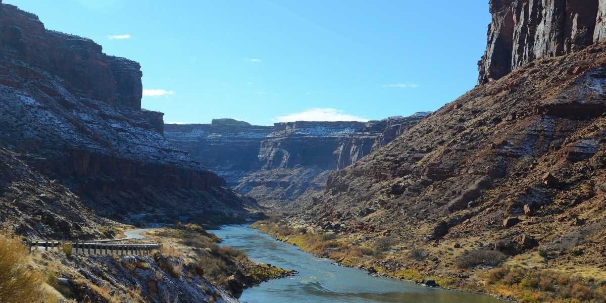
Reservoirs have allowed the Colorado River system to continue supplying users even when annual river flows fall short of demand. Hoover Dam, completed in 1935, created Lake Mead, while Glen Canyon Dam, completed in 1964, created Lake Powell.
Together, the two reservoirs function as a large storage system. Lake Powell is upstream of Lake Mead, with the Colorado River flowing through the Grand Canyon between them.
The Colorado River system has about 60 million acre-feet of reservoir storage capacity. That amount is more than four times the river’s average annual natural flow of 14.9 million acre-feet during the 20th century.
Reservoirs have effectively acted as storage accounts for the basin. Water accumulated during wetter periods could be released when snowmelt and river flows failed to meet the amount required for users.
That system has become increasingly strained because water consumption has continued to exceed natural supply in many years.
Consumption exceeded the river’s natural supply in 16 of the last 24 recorded years. The resulting deficits were covered in part by water stored in reservoirs.
The pattern means the shortage has not been limited to individual dry years. Repeated deficits have reduced the amount of water held in storage and left less capacity to compensate for future shortfalls.
Water use peaked in the late 20th century and has since declined. The reduction in consumption, however, has not eliminated the gap between demand and the river’s natural supply.
The basin has therefore continued drawing more water than the river provides naturally, with reservoir storage covering the difference.
California’s broader water system also depends on supplies outside the Colorado River. Recent reporting on California small farm water risks describes how water availability and irrigation reliability affect agricultural operators, particularly in the Sacramento and San Joaquin valleys.
Lake Mead and Lake Powell Approach Critical Levels
Lake Mead and Lake Powell hold more than 80% of the potential water storage in the Colorado River system. Their levels provide a direct measure of the amount of water available to support the basin when annual river flows are insufficient.
Both reservoirs are at historically low water levels. The prolonged drought and limited runoff have reduced the amount of water available to refill the reservoirs.
The 2025-26 snowpack also produced little runoff, adding to the pressure on stored supplies. Snowmelt in the river’s mountain headwaters provides most of the Colorado River’s streamflow.
The two reservoirs also generate hydropower. Their dams supply electricity for as many as 1.5 million households across seven states.
Reservoir elevation affects both water storage and the ability of the dams to generate electricity. Minimum power pool refers to the lowest level at which a reservoir can still generate electricity, while dead pool is the level at which water can no longer flow through a dam by gravity.
The continued decline in storage therefore has consequences beyond water deliveries. Lower reservoir levels also reduce the margin available for hydropower generation.
The Colorado River’s current deficit has also affected the river’s connection to the sea. Nearly every available drop is now diverted for use, and the river no longer reaches the sea.
The combination of lower natural flows, prolonged drought and declining reservoir storage has left less water available to absorb future deficits. The current federal reductions address part of the immediate shortage through mandatory cuts and voluntary conservation.
Federal Water Allocations Face Reassessment Over the Next Decade
Federal officials will recalculate Colorado River water allocations on a two-year cycle over the next decade. The approach provides repeated opportunities to adjust water sharing as conditions in the basin change.
The federal action follows years of disagreement among the seven states over the division of the river. The Upper Basin consists of Colorado, Wyoming, Utah and New Mexico, while California, Arizona and Nevada form the Lower Basin.
Mexico also has an allocation under the Colorado River system.
The existing division is based on the 1922 flow estimate of 16.4 million acre-feet. Actual river flows have been lower, particularly during the drought that began in the late 20th century and continued through the current period.
The recent average of about 12.3 million acre-feet from 2000 to 2025 is substantially below both the original 1922 estimate and the 20th-century average.
The federal government has imposed a 21% reduction in Lower Basin water use over the next two years through mandatory reductions and voluntary conservation. The reductions shown for California, Arizona and Nevada differ by state.
Federal officials will also monitor reservoir conditions. Emergency actions would be triggered if either Lake Powell or Lake Mead fell to a level that threatened its ability to generate hydropower.
California’s water planning includes other supply sources and management measures, including groundwater. A recent California groundwater loss study examined changes in Central Valley groundwater supplies and the relationship between climate-related effects and irrigation demand.
The Colorado River’s allocation system therefore faces two separate constraints: established water commitments exceed recent natural flows, while reservoir storage has been used repeatedly to cover the difference.
For California, the federal reductions directly affect one of the state’s established Colorado River water sources. The state’s water supplies are now being managed within a system where recent river flows are substantially below the levels used when the original allocation framework was established.
Frequently Asked Questions
How much Colorado River water does California receive?
The Colorado River allocation system divides 16.4 million acre-feet among the Upper Basin, Lower Basin and Mexico. California is one of the three Lower Basin states, alongside Arizona and Nevada, subject to the current federal reductions.
Why is California facing Colorado River water cuts?
California is facing reductions because the Colorado River’s natural supply has been below consumption during many recent years. Prolonged drought, lower river flows, depleted reservoirs and the inability of the seven basin states to agree on water sharing led to federal intervention.
How low are Lake Mead and Lake Powell?
Both Lake Mead and Lake Powell are at historically low water levels. Together, they contain more than 80% of the Colorado River system’s potential water storage.
How much has Colorado River flow declined since 2000?
The river’s average annual natural flow was about 14.9 million acre-feet during the 20th century. That average fell to about 12.3 million acre-feet from 2000 through 2025.
How will federal officials manage Colorado River allocations over the next decade?
Federal officials will recalculate water allocations on a two-year cycle over the next decade. Emergency actions would be triggered if Lake Powell or Lake Mead reached levels that threatened hydropower generation.